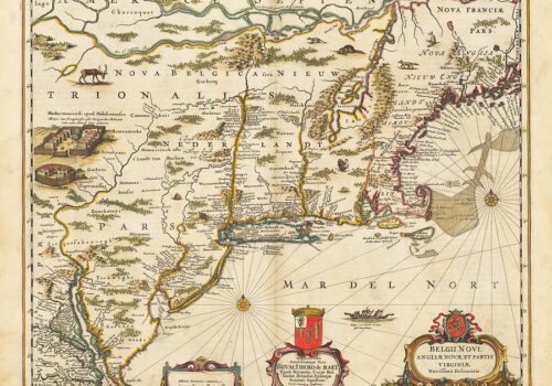
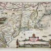
Novi Belgii Novaeque Angliae. (New Netherland and New England.) mid-1650’s Mapmaker: Justus Danckerts This plate was produced in the mid-1650’s, engraved as a copy of...
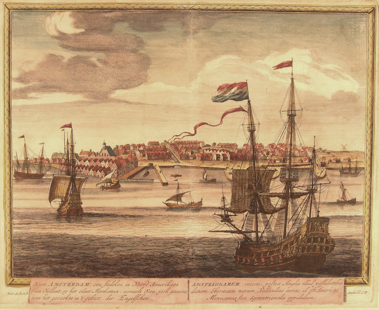
Nova Belgica et Anglia Nova. (New Netherland and New England.) 1694. Mapmakers: Peter Schenk and Gerard Valk Janssonius sold his 1635 plate to Peter Schenk...
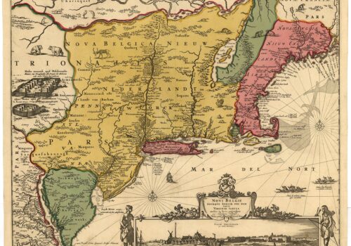
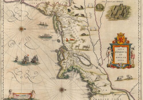
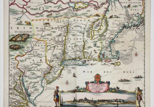
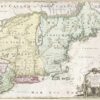
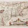
Belgii Novi, Angliae Novae et Partis Virginiae (New Netherland, New England and parts of Virginia) 1650. Mapmakers: (Janssonius or Jansson) Jansz and (Johannes or Johan)...
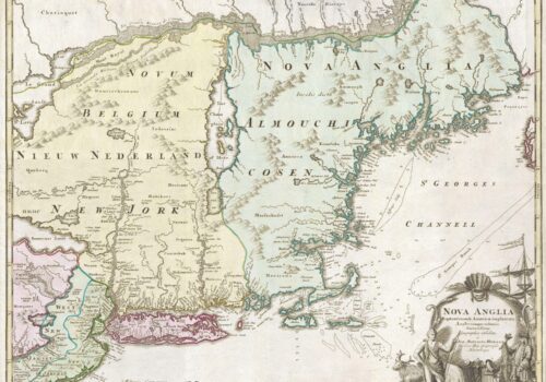
Nova Anglia Septentrionali Americae implantate (New England Situated in North America) Nuremberg, 1724 Mapmaker: Johann Baptiste Homann One of the few collectible maps of the...
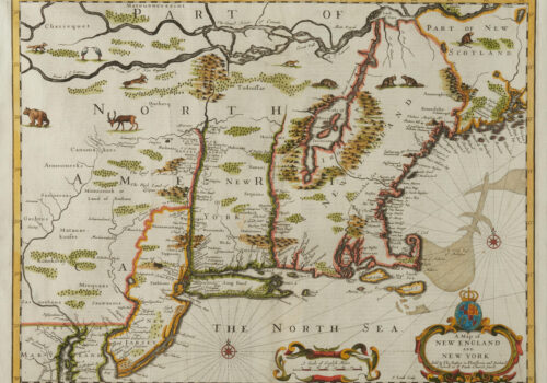
A Map of New England and New York Sold by Tho: Basset in Fleetstreet and Richard Chiswell in St. Paul’s Church Yard – F. Lamb...
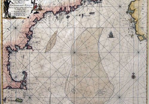
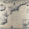
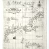
Pas-Kaart vande Zee Kusten Inde Boght van Niew Engeland tusschen de Staaten Hoekven C. de Sable Door Vooght geometra t’Amsterdam. (Chart of the Sea Coast...
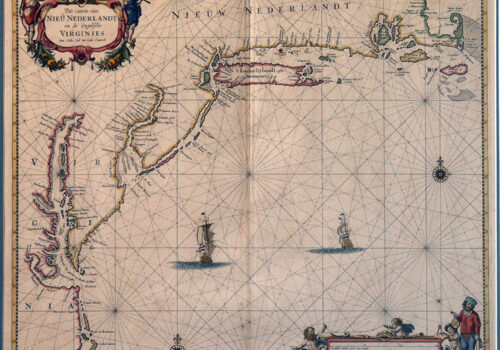
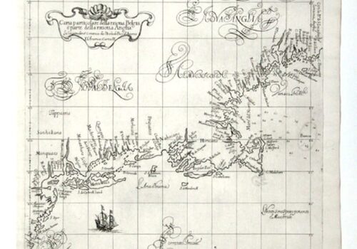
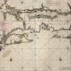
Pas Caerte van Nieu Nederlandt en de Engelsche Virginies, van Cabo Cod tot Cabo Canrick. (Chart of New Netherland and the English Virginias from Cape...
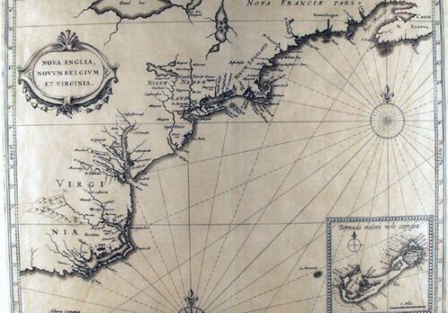
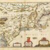
Nova Anglia, Novum Belgium, et Virginia (New England, New Netherland, and Virginia) 1636. Mapmakers: (Janssonius or Jansson) Jansz and (Johannes or Johan) Jan This is...
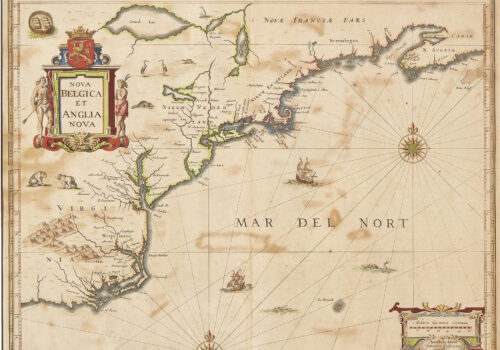
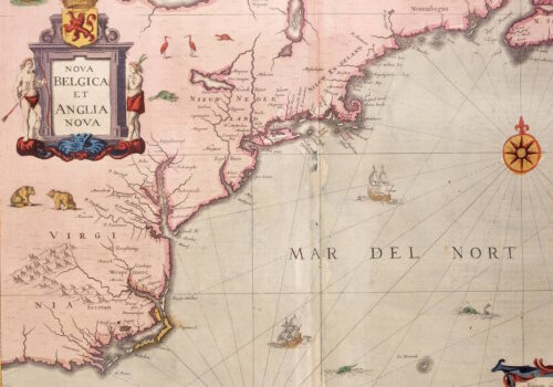
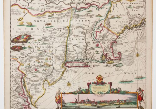
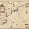
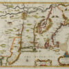
Nova Belgica et Anglia Nova. (New Netherland and New England), 1635 Mapmaker: Willem Blaeu This is the engraved version of Adriaen Block’s 1614 manuscript map...
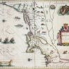
Mapmakers: Hessel Gerritsz and Ioannes de Laet This landmark work, the foundation map of New Netherland’s printed patrimony, places the Dutch claim in its geographic...
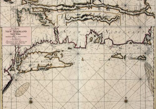
Mapmaker: Johannes van Keulen The part so far left out of this tale of European awareness of Northeast America are the maps which guided the...
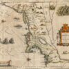
Mapmaker: Justin Dankerts This third-generation example of the Jansson-Visscher series is most lavishly decorated. It adds additional animals and place names and reflects with greater...
Mapmaker: Nicolaes Visscher The Jansson-Visscher series of maps of New Netherland and New England is an example of the practice of the replication, correction and addition...
Mapmaker: Robert Dudley Tinting (adding color) either contemporaneously or later has always been a part of map making. An exception are the 130 maps of...
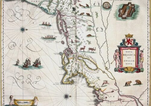
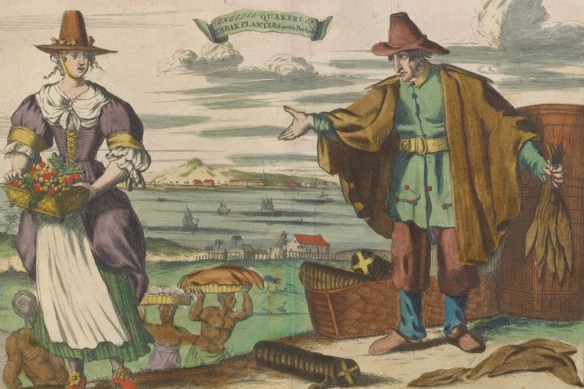
This map of New Netherland and New England, based on Adrian Block’s 1614 chart, defined Manhattan and Long Island as islands and became the cornerstone of Dutch claims in the lower Northeast. Richly decorated with regional fauna, it also shows fortified Mohawk villages, canoes, and European ships reflecting growing knowledge and economic potential.
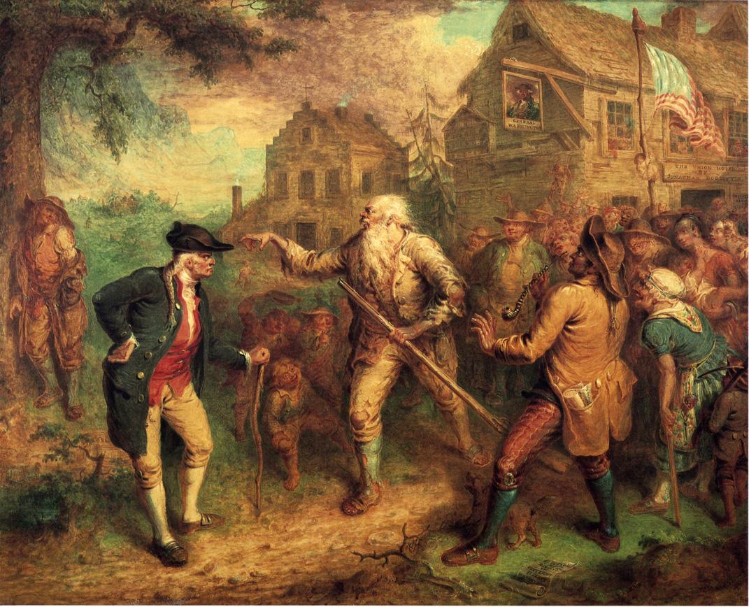
In 1664, Dutch rule ended as New Netherland passed to the English. Peace treaties promised continued trade and justice, but Native peoples now faced new colonial powers—and, eventually, war, displacement, and upheaval.
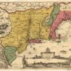
Novi Belgii Novaeque Angliae. (New Netherland and New England.) mid-1650’s Mapmaker: Justus Danckerts This plate was produced in the mid-1650’s, engraved as a copy of...
Nova Belgica et Anglia Nova. (New Netherland and New England.) 1694. Mapmakers: Peter Schenk and Gerard Valk Janssonius sold his 1635 plate to Peter Schenk...
Belgii Novi, Angliae Novae et Partis Virginiae (New Netherland, New England and parts of Virginia) 1650. Mapmakers: (Janssonius or Jansson) Jansz and (Johannes or Johan)...
Nova Anglia Septentrionali Americae implantate (New England Situated in North America) Nuremberg, 1724 Mapmaker: Johann Baptiste Homann One of the few collectible maps of the...
A Map of New England and New York Sold by Tho: Basset in Fleetstreet and Richard Chiswell in St. Paul’s Church Yard – F. Lamb...
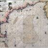
Pas-Kaart vande Zee Kusten Inde Boght van Niew Engeland tusschen de Staaten Hoekven C. de Sable Door Vooght geometra t’Amsterdam. (Chart of the Sea Coast...
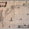
Pas Caerte van Nieu Nederlandt en de Engelsche Virginies, van Cabo Cod tot Cabo Canrick. (Chart of New Netherland and the English Virginias from Cape...

Nova Anglia, Novum Belgium, et Virginia (New England, New Netherland, and Virginia) 1636. Mapmakers: (Janssonius or Jansson) Jansz and (Johannes or Johan) Jan This is...
Nova Belgica et Anglia Nova. (New Netherland and New England), 1635 Mapmaker: Willem Blaeu This is the engraved version of Adriaen Block’s 1614 manuscript map...
Mapmakers: Hessel Gerritsz and Ioannes de Laet This landmark work, the foundation map of New Netherland’s printed patrimony, places the Dutch claim in its geographic...
Mapmaker: Johannes van Keulen The part so far left out of this tale of European awareness of Northeast America are the maps which guided the...
Mapmaker: Justin Dankerts This third-generation example of the Jansson-Visscher series is most lavishly decorated. It adds additional animals and place names and reflects with greater...
Mapmaker: Nicolaes Visscher The Jansson-Visscher series of maps of New Netherland and New England is an example of the practice of the replication, correction and addition...
Mapmaker: Robert Dudley Tinting (adding color) either contemporaneously or later has always been a part of map making. An exception are the 130 maps of...
This map of New Netherland and New England, based on Adrian Block’s 1614 chart, defined Manhattan and Long Island as islands and became the cornerstone of Dutch claims in the lower Northeast. Richly decorated with regional fauna, it also shows fortified Mohawk villages, canoes, and European ships reflecting growing knowledge and economic potential.
In 1664, Dutch rule ended as New Netherland passed to the English. Peace treaties promised continued trade and justice, but Native peoples now faced new colonial powers—and, eventually, war, displacement, and upheaval.