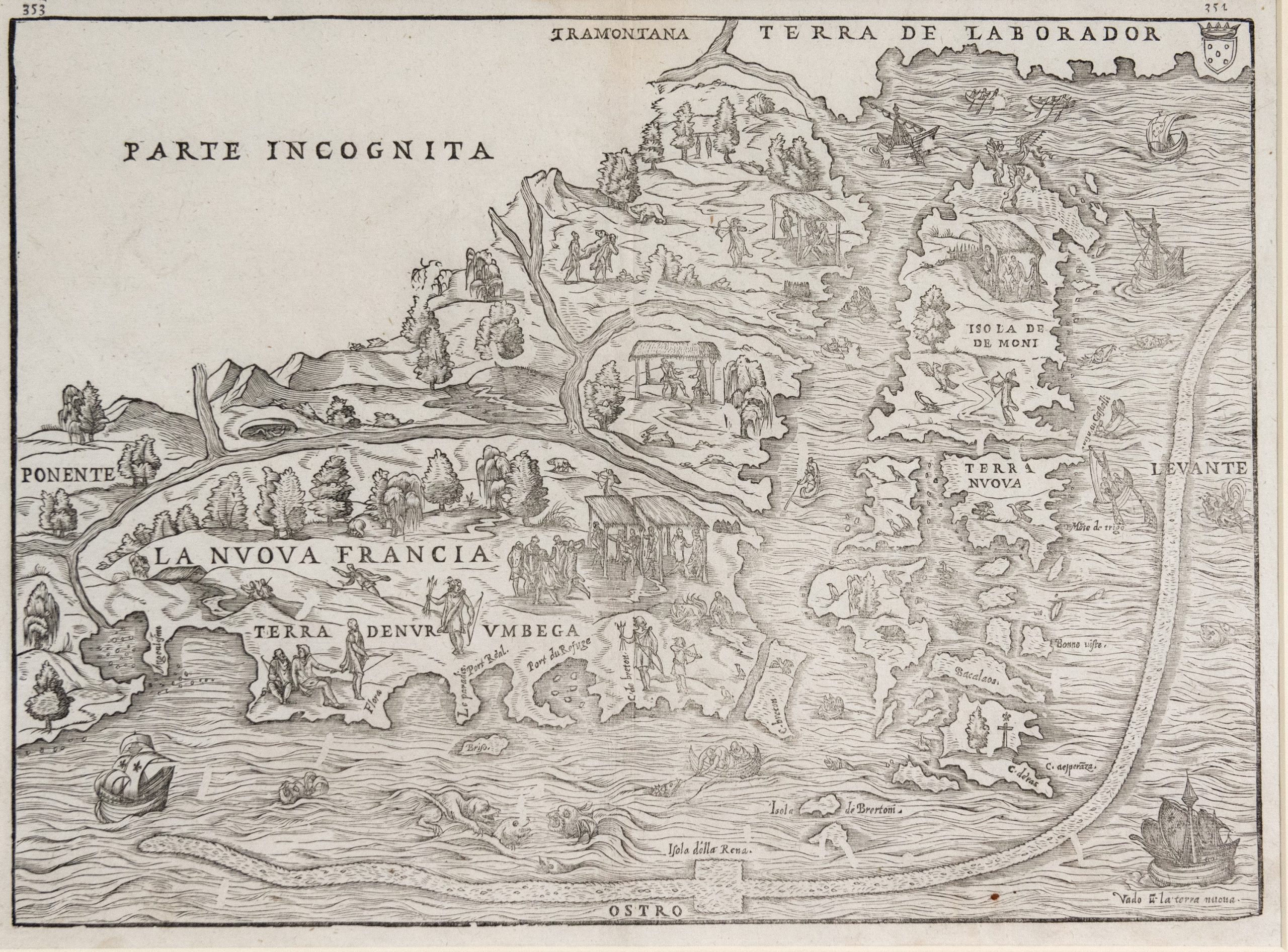
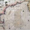
The Northeast/New York City, 1556
01
Mapmakers: Hessel Gerritsz and Ioannes de Laet This landmark work, the foundation map of...
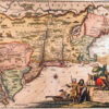
02
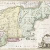
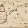
Nova Belgica et Anglia Nova. (New Netherland and New England), 1635 Mapmaker: Willem Blaeu...
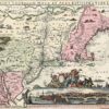
03

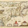
Nova Anglia, Novum Belgium, et Virginia (New England, New Netherland, and Virginia) 1636. Mapmakers:...
04
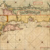
Pas Caerte van Nieu Nederlandt en de Engelsche Virginies, van Cabo Cod tot Cabo...
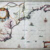
05
Pas-Kaart vande Zee Kusten Inde Boght van Niew Engeland tusschen de Staaten Hoekven C....
06
A Map of New England and New York Sold by Tho: Basset in Fleetstreet...
07
Nova Anglia Septentrionali Americae implantate (New England Situated in North America) Nuremberg, 1724 Mapmaker:...
08
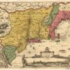
Belgii Novi, Angliae Novae et Partis Virginiae (New Netherland, New England and parts of...
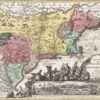
09
Nova Belgica et Anglia Nova. (New Netherland and New England.) 1694. Mapmakers: Peter Schenk...
10
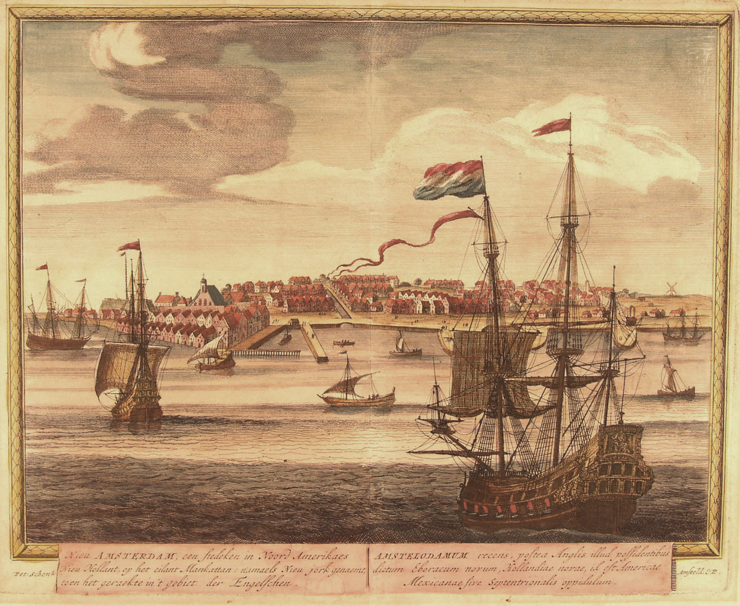
Novi Belgii Novaeque Angliae. (New Netherland and New England.) mid-1650’s Mapmaker: Justus Danckerts This...
11
Mapmaker: Montanus, Arnoldus This map was first published in Montanus’ book De Nieuwe en Onbekende...
12
Pas-Kaart vande zee kusten van Niew Nederland anders genaamt Niew York. (Chart of the...
13
Novi Belgii, quod nunc Novi Jorck vocatur, Novaeque Anglia et partis Virginiae. (New Netherland,...
14
Totius Neo Belgii, nova et accuratissima tabula. (All of New Netherland Newly and Most...
15
Nova Belgica et Anglia Nova (New Netherland and New England). Amsterdam, 1647. Mapmakers: (Janssonius...
16
Recens edita totius Novi Belgii in America Septentrionali. (A New Edition of All of...
17
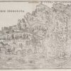
The Northeast/New York City, 1556 Mapmakers: Giacomo Gastaldi and J.B. Ramusio The first printed...
18
Nieuw Engeland in Twee Scheeptogen door Kapitein Johan Smith inde iaren 1614 en 1615...
19
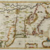
Norumbega et Virginia. (Norumbega [i.e. North America] and Virginia.) 1597. Mapmaker: Cornelius Wytfliet A...
20
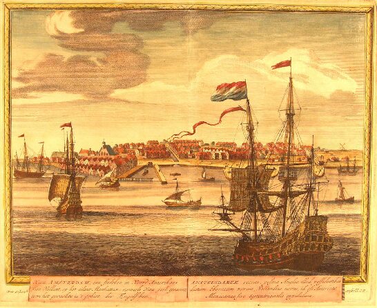
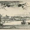
Nieu Amsterdam, een stedeken in Noord Amerikaes Nieu Hollant, op het eilant Mankattan: Namaels...