for
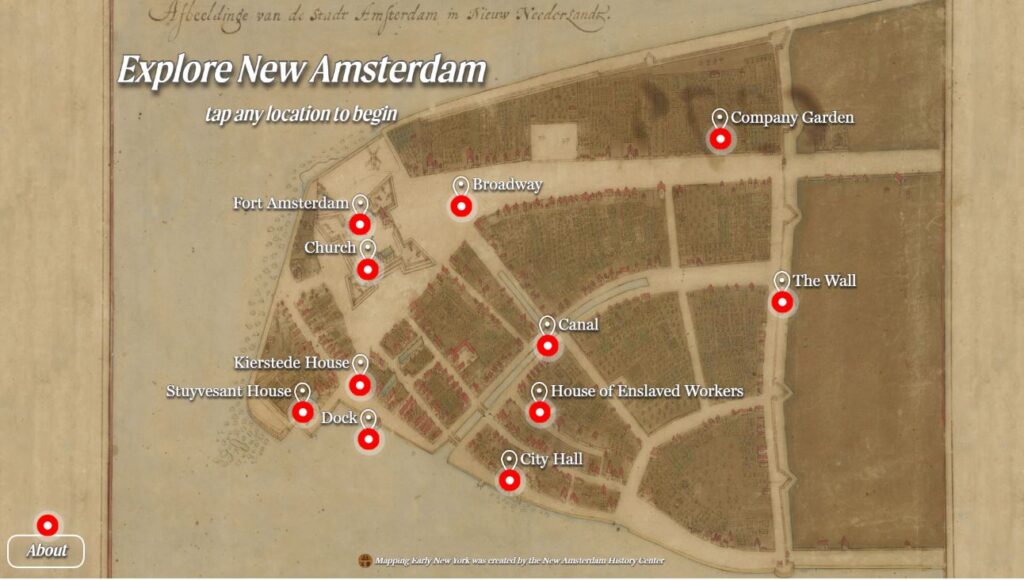
Digital Walking Tour of New Amsterdam
Exploring Dutch Heritage Through Research
Exploring Dutch Heritage Through Research
Welcome! You can explore everything you're looking for in the NNI library. Simply type a keyword into the search bar and press Enter to begin your search.
New membership are not allowed.