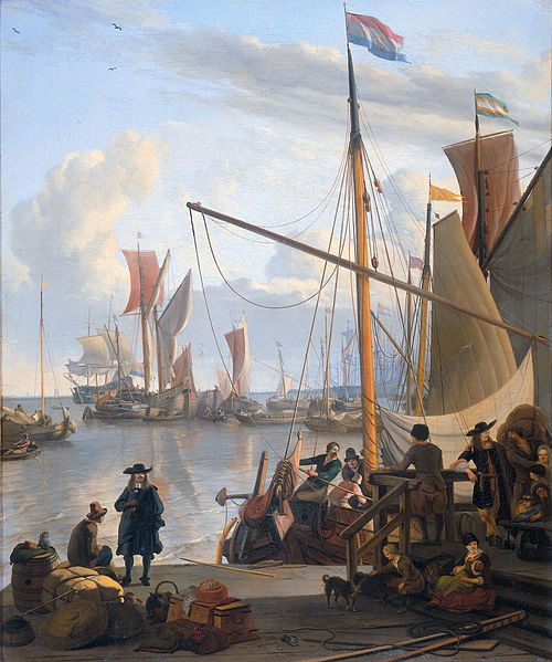
Sailing the Brouwer Route to the East Indies
During the first decade of trade with the East Indies, a Dutch retourschip leaving Texel bound for the East Indies followed the old route that Arab and Portuguese sailors took—south
down the west coast of Africa, around the Cape of Good Hope, northeast through the Mozambique Channel and across the Indian Ocean, sometimes via India or Ceylon.
by Peter A. Douglas
The ship then headed east through the Strait of Malacca to Java. Because the Portuguese had established fortified trading centers in Mozambique, the Dutch would also sail up the east coast of Madagascar, often as far as Mauritius.
This arduous voyage could take up to a year, and was tough on ships and men. The winds suited the homeward journey, but the outward voyage was slow going, and ships were often becalmed for long periods, with pitch between the planks melting under the hot sun, fresh supplies diminishing, cargo rotting, and always the threat of scurvy or typhus. All this changed thanks to a Dutch explorer and colonial administrator called Hendrik Brouwer (1581-1643).
On one of his voyages to the Indies beginning in 1610, Brouwer found a better route. After reaching the “roaring forties” at the southern tip of Africa, instead of heading for Madagascar he continued due eastward through the Southern Ocean. The “roaring forties” are strong westerly winds found in the southern hemisphere between latitudes 40 and 50 degrees. They blow hard as they are uninterrupted by any land mass. These same winds were a big help to sailing ships on the East Indies and Australia runs ever since. The fast clipper ships of the nineteenth century sailed the Brouwer Route (then known as the “clipper route”) from Europe to the Far East, Australia, and New Zealand. In 1868-69, the clipper ship Thermopylae sailed from London to Melbourne in 61 days—still the fastest trip under sail.
When Brouwer calculated that he had sailed eastward far enough and reached the same longitude as the Sunda Strait between Sumatra and Java, he turned north. He arrived at his destination in just under six months, cutting the duration of the voyage in half. This came to be known as the “Brouwer Route.”
In late 1611 Brouwer wrote to the Dutch East India Company informing them of his new route and saying that he had “a steady westerly wind for 28 days.” He set out the benefits of using is route: “For several reasons we consider this route the best which has been used east of the Cape Bone Esperance [Cape of Good Hope] to this day, firstly, the preservation of the cargo of the ships as well as the provisions, because they keep cool for a longer time, in contrast with the route inside or outside Madagascar to northward, where one reaches the heat very soon. We also feel that our people will keep fit longer in the cool than in the heat of the equator … On this route you do not have to fear any encounter with shallows or dangerous islands.” Unbeknownst to Brouwer, the shallows and dangerous islands off Australia farther to the east were indeed hazards that many off-course ships would face.
Shaving six months off the Europe-Indies travel time had obvious benefits for the condition of both the ships and their crew, and also for the company, for which the faster turnaround time meant more profit and significantly reduced overheads. Other ships followed Brouwer’s new course and confirmed his findings. This prompted the VOC to issue a seynbrief, or sailing order, in 1617, making using this route mandatory for all company ships. Skippers leaving the Cape of Good Hope were to choose the southern latitudes where they could find the best winds and sail due east for about 4,000 miles before laying course for the north and the Indies.
However, along with clear advantages, the Brower Route also brought veiled problems. The success of this route depended very much on the navigational skills of the ships’ captains, and those not skilled enough paid a price. While navigators at the time could measure latitude (distance north or south of the equator), they could not accurately calculate longitude (coordinates specifying the east-west position of a point on the earth’s surface). The down side of Brouwer’s Route stemmed from the fundamental lack of a reliable method for establishing longitude, which had to be based on dead reckoning, a most inexact science. Measuring longitude meant measuring time, and sailors would have to wait until the middle of the eighteenth century for an accurate, portable marine chronometer. Until then there was ample room for error.
A miscalculation in longitude could result in a ship overshooting the correct place to turn northward for the Indies. Unfortunately some of these navigational errors led to disasters when ships sailed on too far to the east and were wrecked on the desolate coast of western Australia or its offshore islands. Western Australia has a long and difficult shore with few natural harbors, and storms in that area often create strong on-shore winds that can drive ships ashore. Little did Brouwer know that not far across the horizon from the point where he had turned north in 1610 lay some of the most dangerous and treacherous coastline in the world—coastline that in the years to follow would claim the lives of hundreds of Dutch sailors and millions of VOC guilders in the form of doomed ships and their lost cargo.
Four VOC ships are known to have to have been wrecked on this coast or off-lying reefs: Batavia (1629), Vergulde Draek (1656), Zuytdorp (1712), and Zeewijk (1727). The fate of three other VOC ships is unknown for they were lost without trace after leaving the Cape of Good Hope: Ridderschap van Holland (1694), Fortuyn (1723), and Aagtekerke (1726). The assumption is that they were wrecked off Australia. And in 1622, the English ship Tryall had the dubious honor of being Australia’s first known shipwreck when its skipper, inexperienced with Brouwer’s route, misjudged his position and delayed his northward turn, ending up on the then uncharted rocks at the edge of the Montebello Islands, sixty-five miles off the mainland. They are now known as the Tryall Rocks.
Hendrik Brouwer could not have guessed that in devising his revolutionary sea route he started a chain of events that led not only to several maritime catastrophes but also to the sighting and exploration of a new southern continent. Following Brouwer, and thanks to imperfect contemporary navigational techniques, the inadvertent discovery of western Australia—one way or another—was virtually assured.