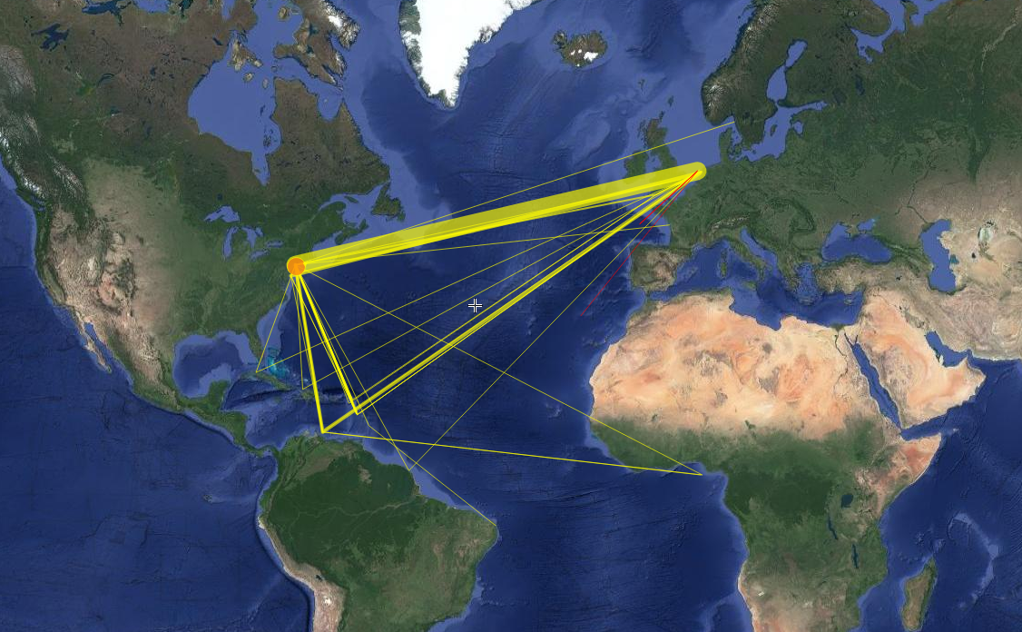
Now Reading:

Route Map

Font Selector
Sans Serif
Serif
Font Size
A
A
You can change the font size of the content.
Share Page

Exploring Dutch Heritage Through Research 

Exploring Dutch Heritage Through Research 

Route Map

The map represents the various routes ships took to get to New Netherland. Thicker lines indicate a higher number of voyages using that route. By far, the greatest number of voyages sailed directly from the Dutch Republic to New Netherland, though it is likely that more voyages stopped in Curaçao than is reflected in the records. This map places New Netherland firmly in the seventeenth-century Atlantic arena.

  • Voyages of New Netherland


  • About New Netherland Institute

    For over three decades, NNI has helped cast light on America's Dutch roots. In 2010, it partnered with the New York State Office of Cultural Education to establish the New Netherland Research Center, with matching funds from the State of the Netherlands. NNI is registered as a 501(c)(3) non-profit organization. Contributions are tax-deductible to the extent permitted by law.